
Michele Borzoni
Book, Exhibition
2021
Michele Borzoni
Book, Exhibition
2021
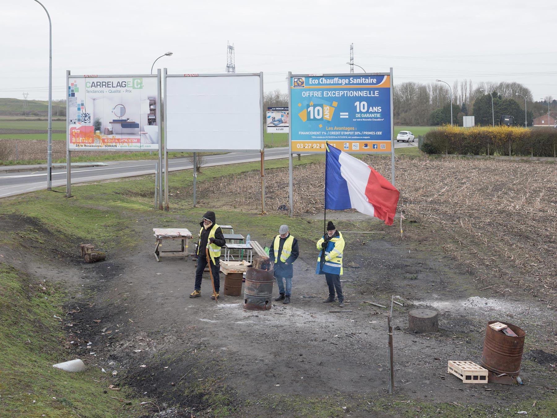
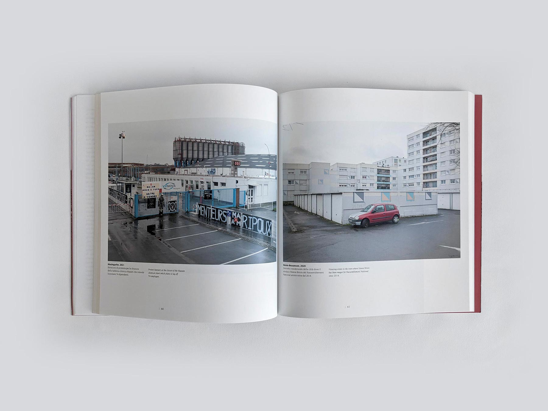
Aniche 2021. Gilets jaunes at a permanent picket on the town’s roundabout.
Down to the early 21st century, the Nord-Pas-de-Calais mining region was a driving force of the French economy, an area that spans some 200 miles near the Belgian border. Coal, steel, and textiles created wealth for many generations. With the advent of globalization and the offshoring of production, however, the once progressive working classes began to be impoverished, prompting them to turn to sovereigns and populist ideologies. The economic crisis triggered by subprime securities in the United States and then the pandemic have exacerbated the frailty of an already precarious production system. Nord-pas-de-Calais is the mirror of the crisis of one of the world’s most generous welfare states. The upshot is that the provinces northeast of Paris have become the stronghold of far-right parties and populist movements. This is a very marked phenomenon that can be observed in many industrial areas of old Europe, from the north east of the UK to Taranto in Italy. France, the world’s sixth-biggest economy, has sputtered along for years with virtually no growth. Average unemployment rates have hovered around 10% for several years, and in this corner of France they are higher. Only in the city of Denain, a former industrial district, the unemployment is more than double the national average and the per capita income is 558 euros per month. It is from Denain that the candidate for the regional elections of the Rassemblement National (far-right party led by Marine Le Pen) comes. In the nineteenth century, after the discovery of coal, Denain became one of the cradles of the industrial revolution, between mining and metallurgy. Usinor, the iron and steel plant, employed 15.000 workers. In the nineteenth century, after the discovery of coal, Denain became one of the cradles of the industrial revolution, between mining and metallurgy. Usinor, the iron and steel plant, employed 15,000 people. In two years, 12,000 people left the town.
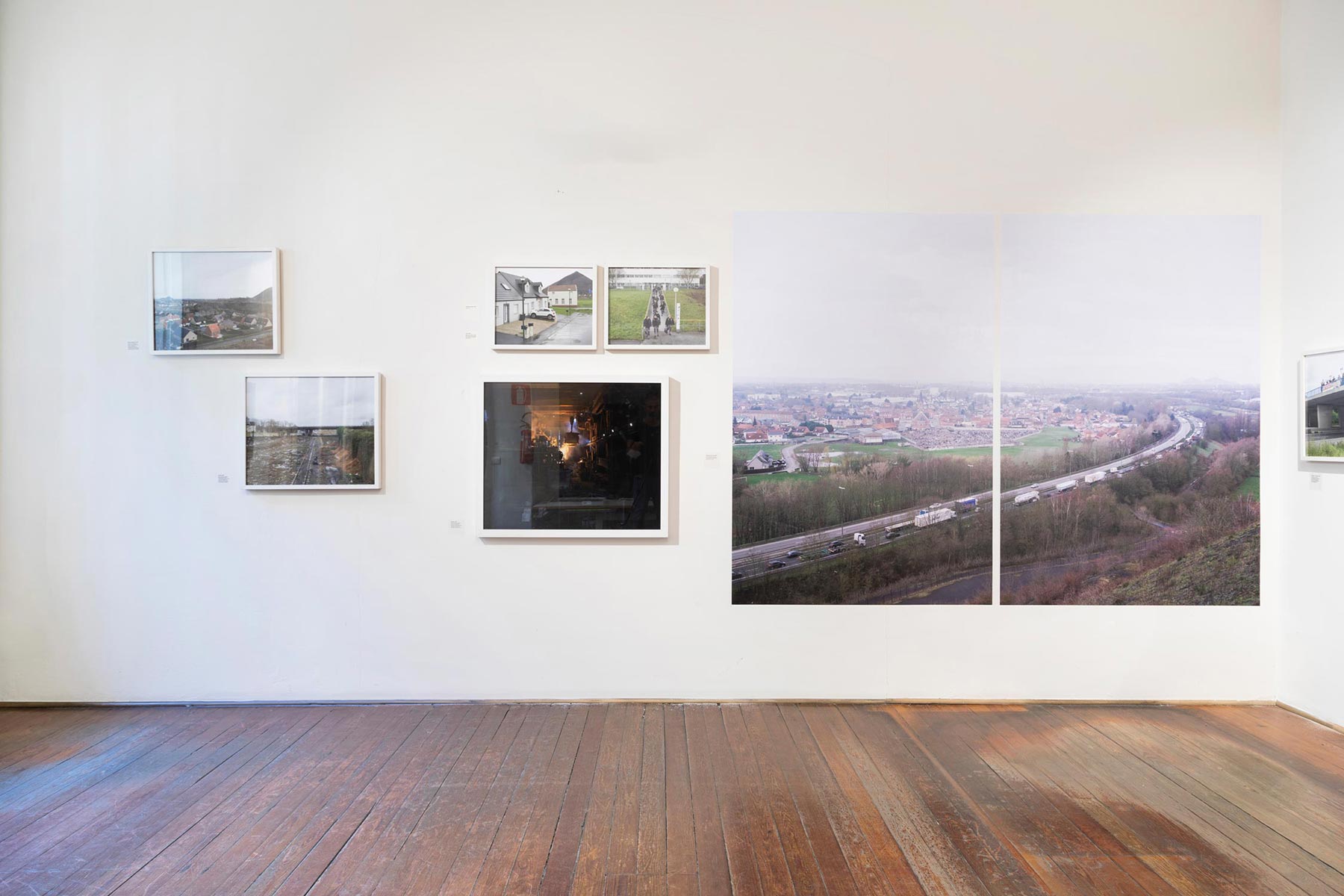
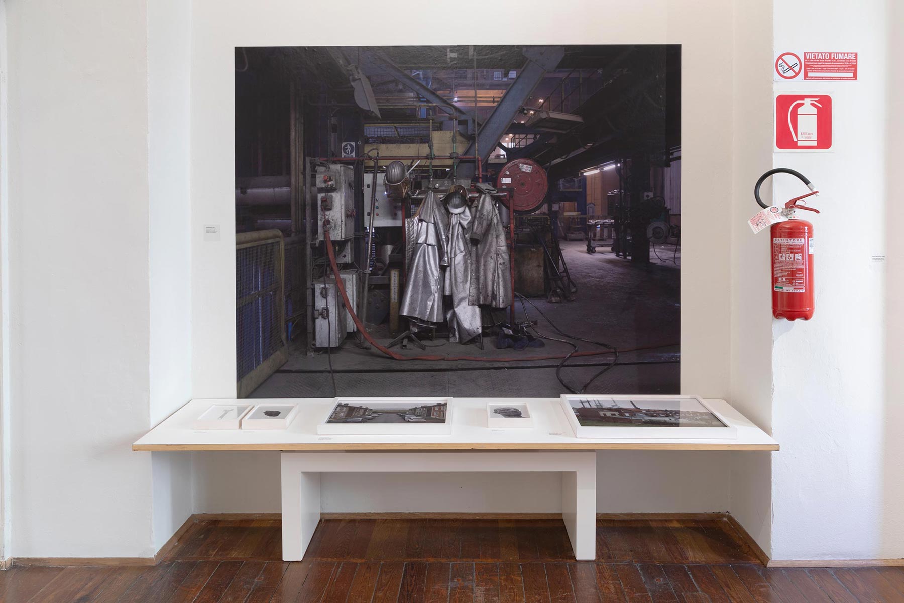
‘Mapping the Rust’ is a photographic survey of the changes in the industrial landscape as well as the social and political changes that have ensued. The project therefore describes of a territory impoverished by the abandonment of work and at the same time betrayed by the leftist social parties. As happened in the American rust belt, with the fall of Detroit’s auto industry, voters were deprived of jobs and wealth accumulated in secondary cities far from the coasts. Rust, coal, steel, textiles, tools, trade unions, sovereignty and populism are at the centre of this investigation.
The book is available from the TerraProject online shop at this link.
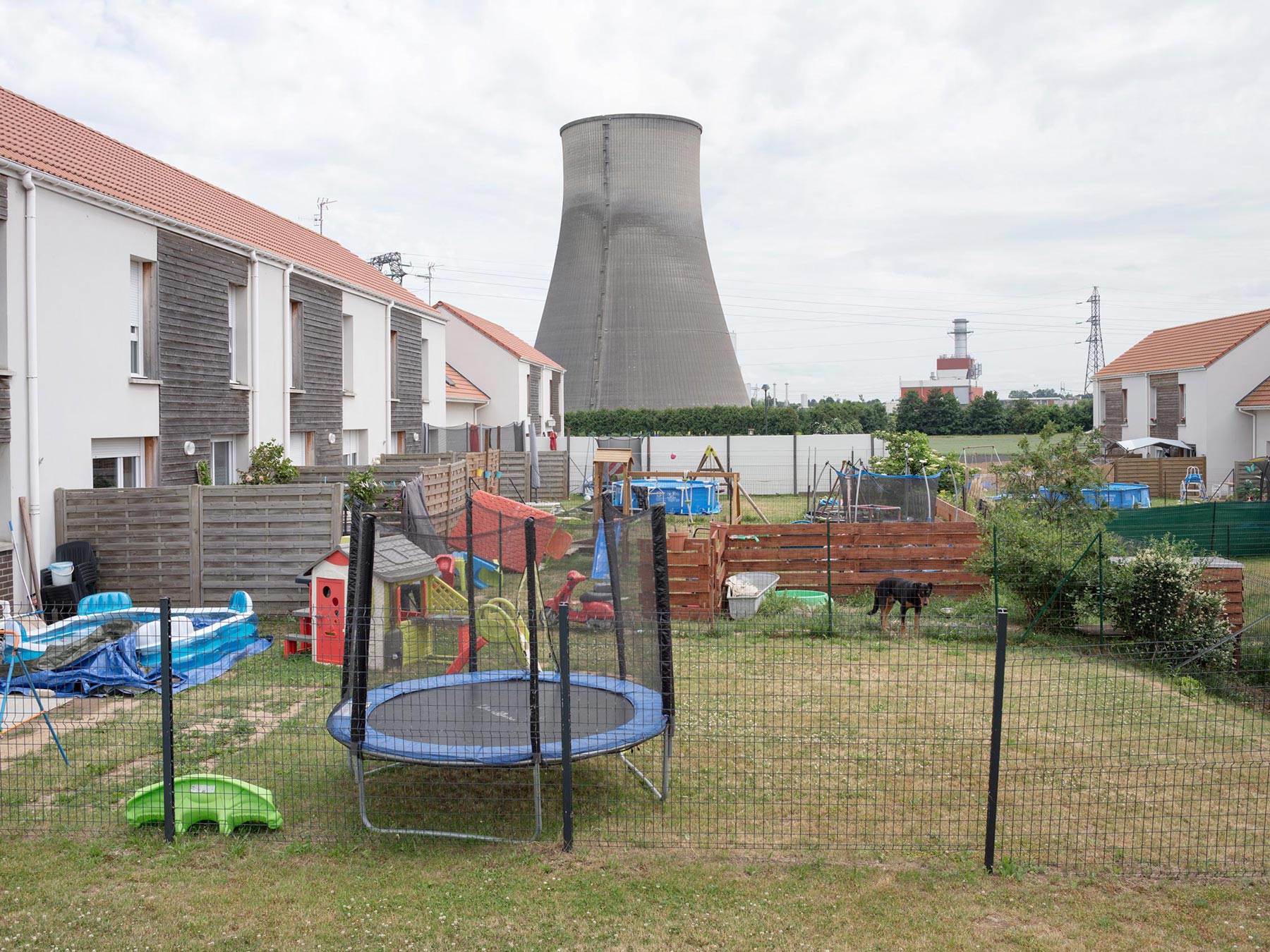
Bouchain, 2021. Coal-fired electric power station until the 1970s, then converted to natural gas.
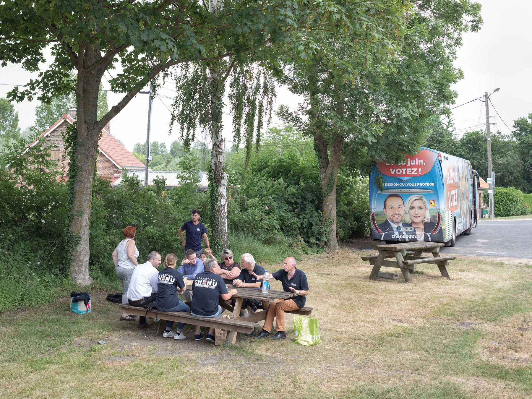
Cambrai Charpentes, 2021. Rassemblement National volunteers campaigning for regional elections.
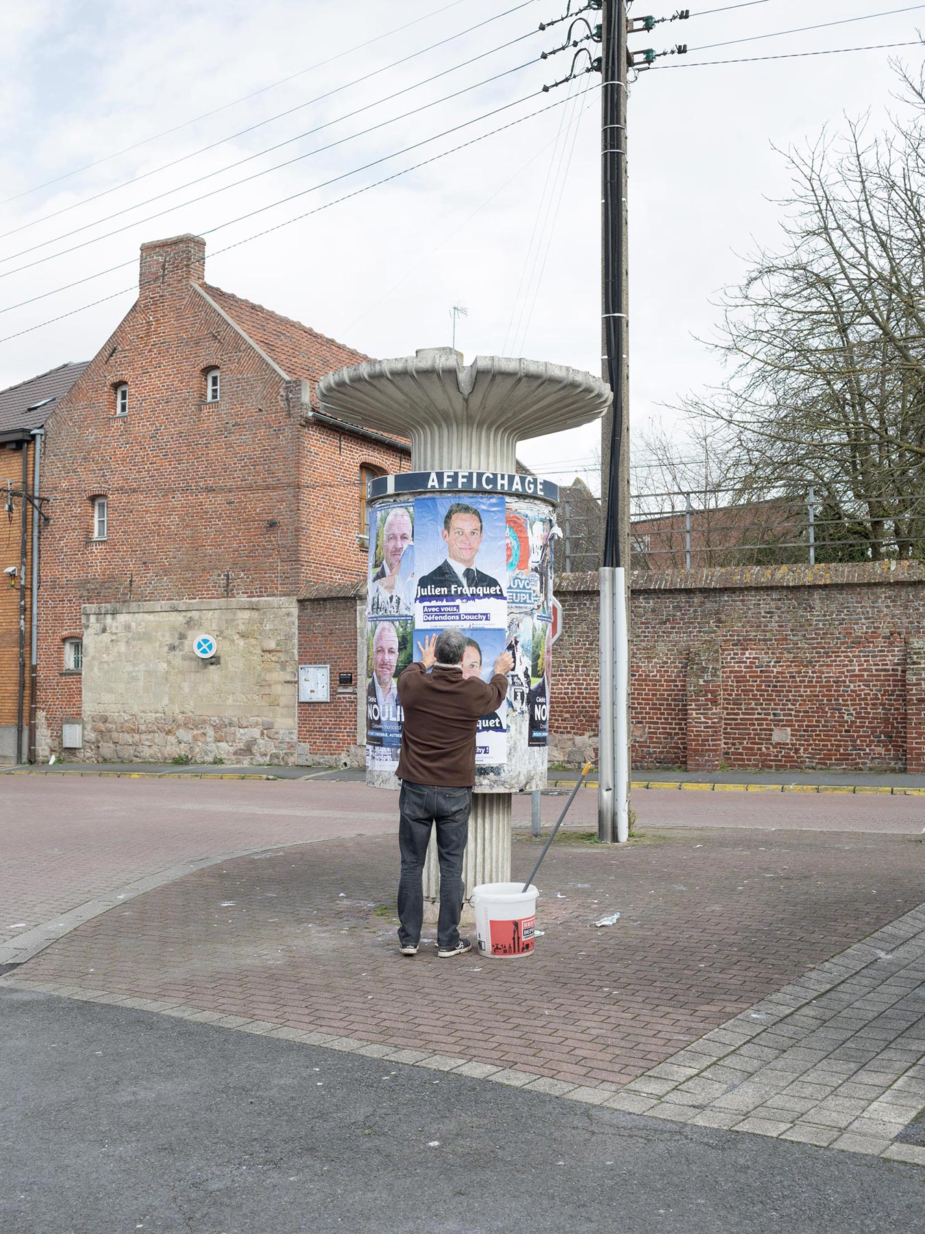
Edouchy-les-Mines, 2020. Election poster of Rassemblement National during the campaign for municipal elections in the city.
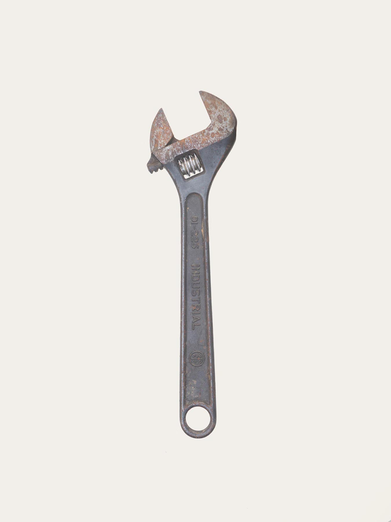
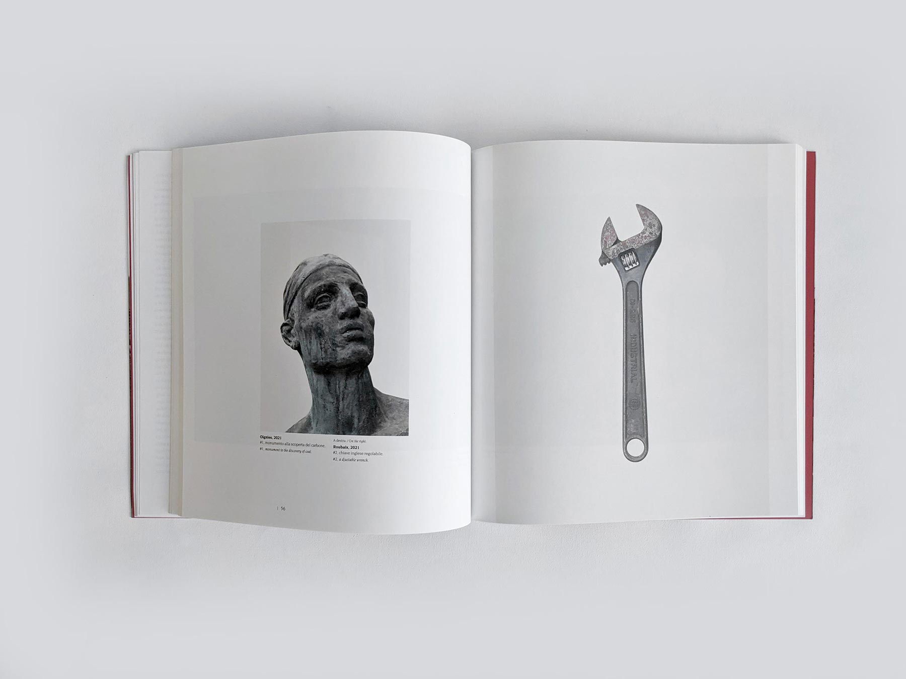
Roubaix, 2021. #2 adjustable wrench
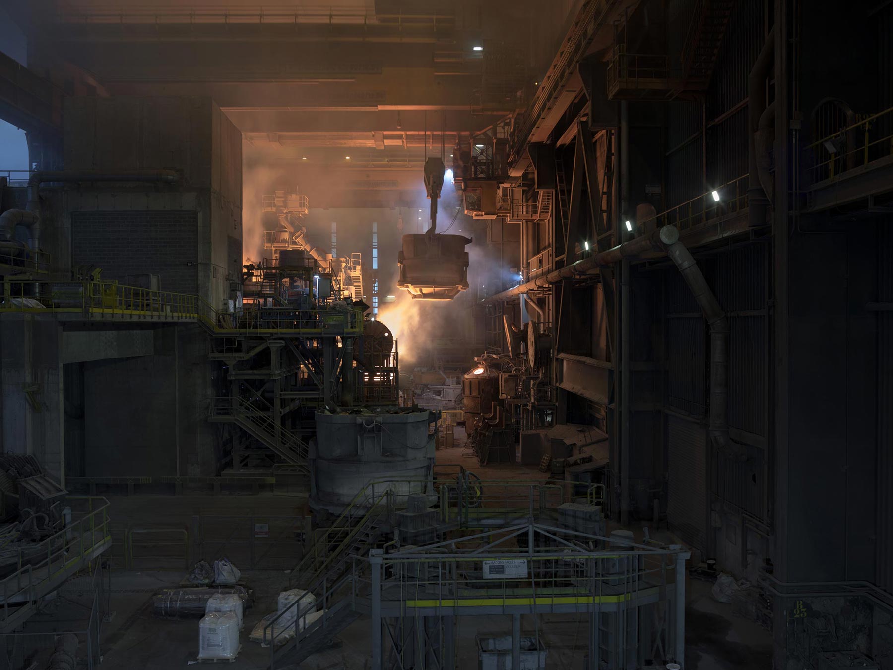
Valenciennes, 2021. The blast furnace at the Ascoval steelworks produced 75,000 tons of steel in 2020 from recycled ferrous materials.
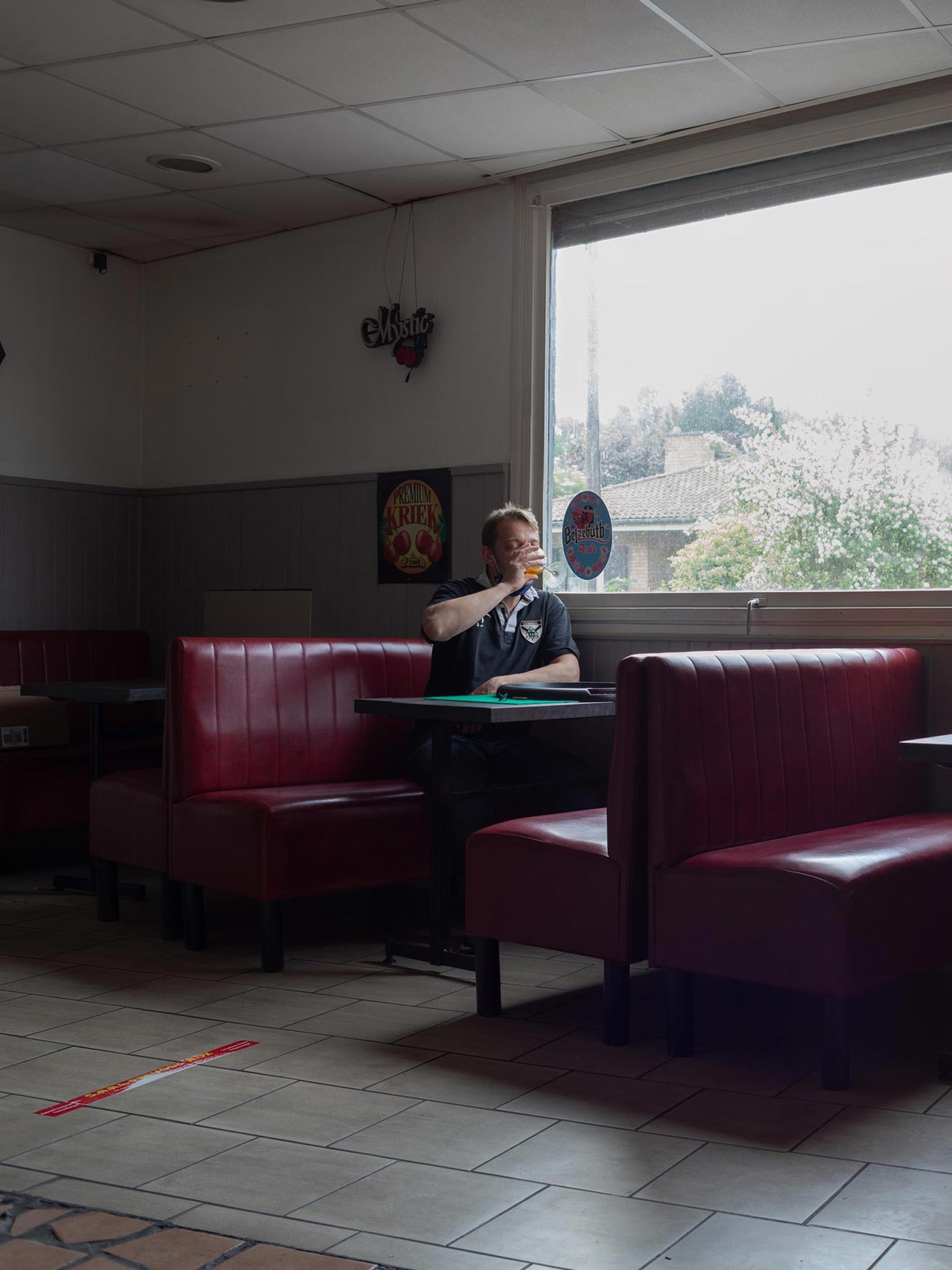
Meurchin, 2021. Café in the former mining town
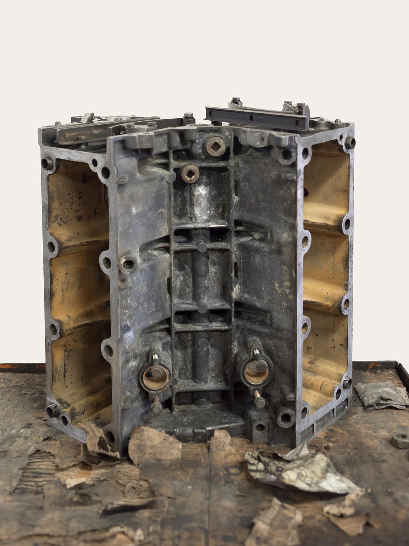
Roubaix, 2021. #3, Peugeot 504 engine block from the seventies

Denain, 2021. Deindustrialized zone of the Usinor steelworks; until it closed in 1988, this industrial giant produced 15% of the steel in the whole of France.
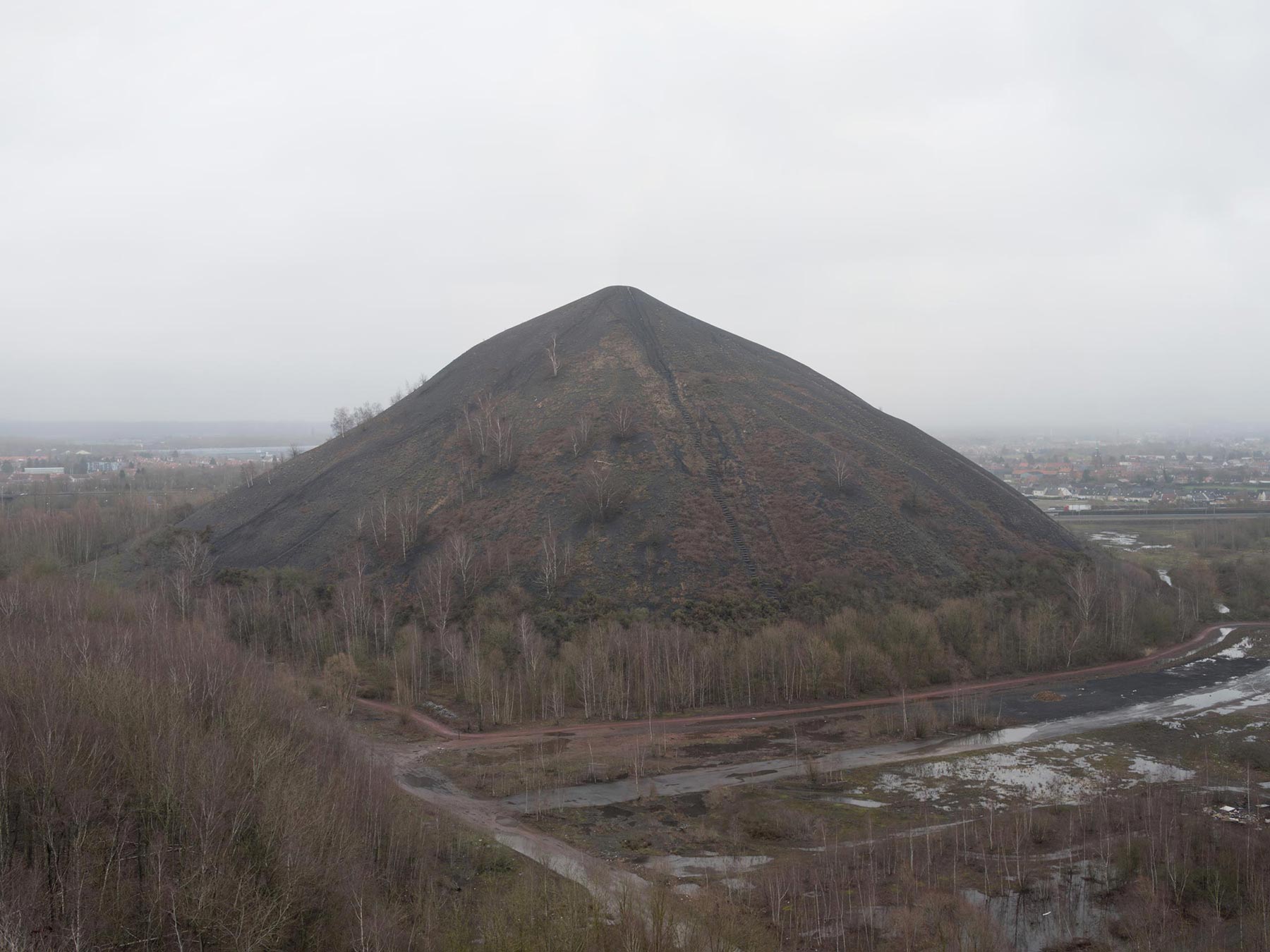
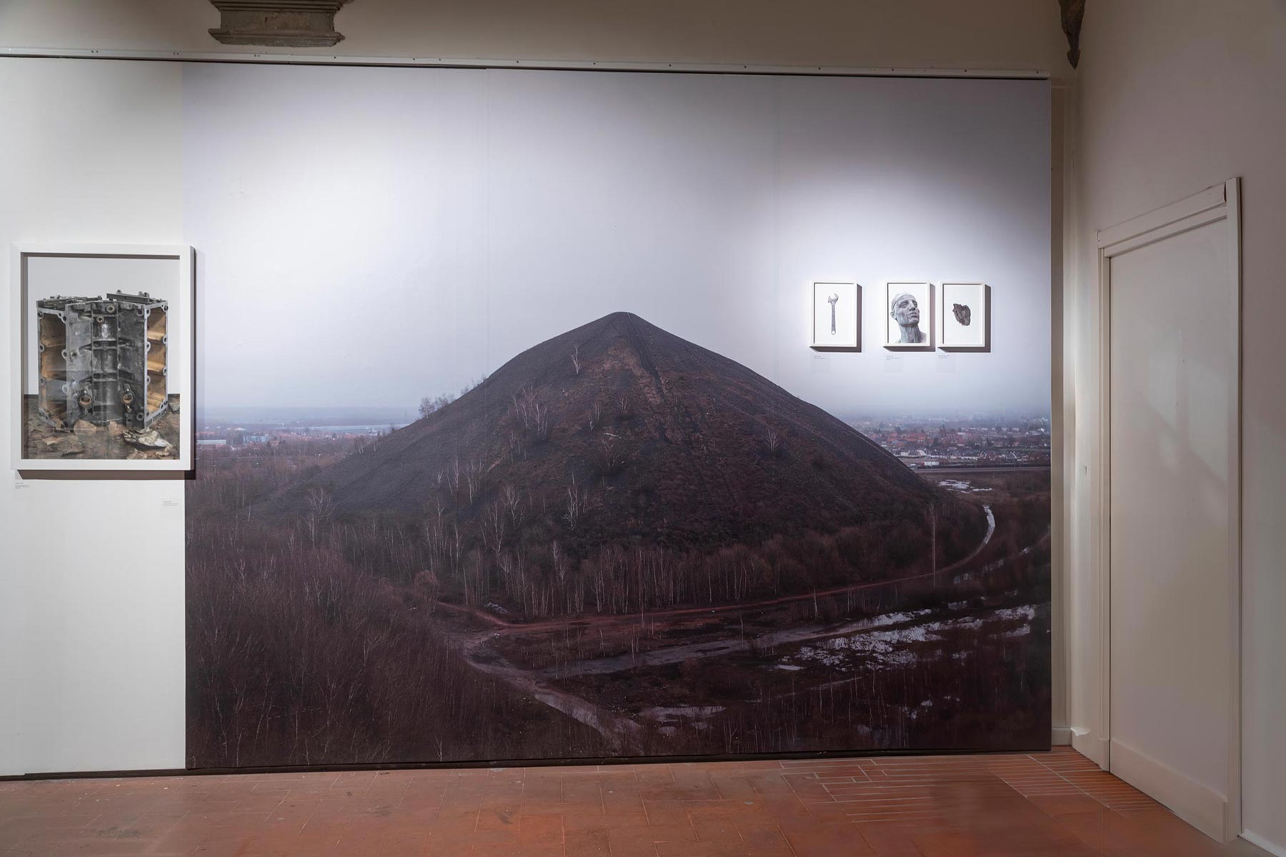
Dourges, 2021. Terril no. 87, slag heap from coal mining
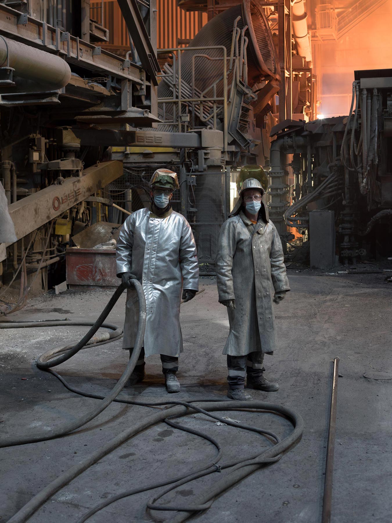
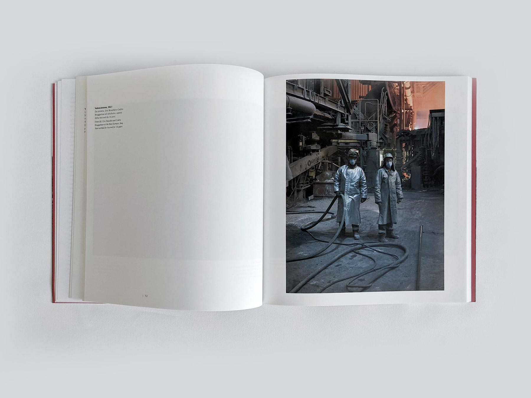
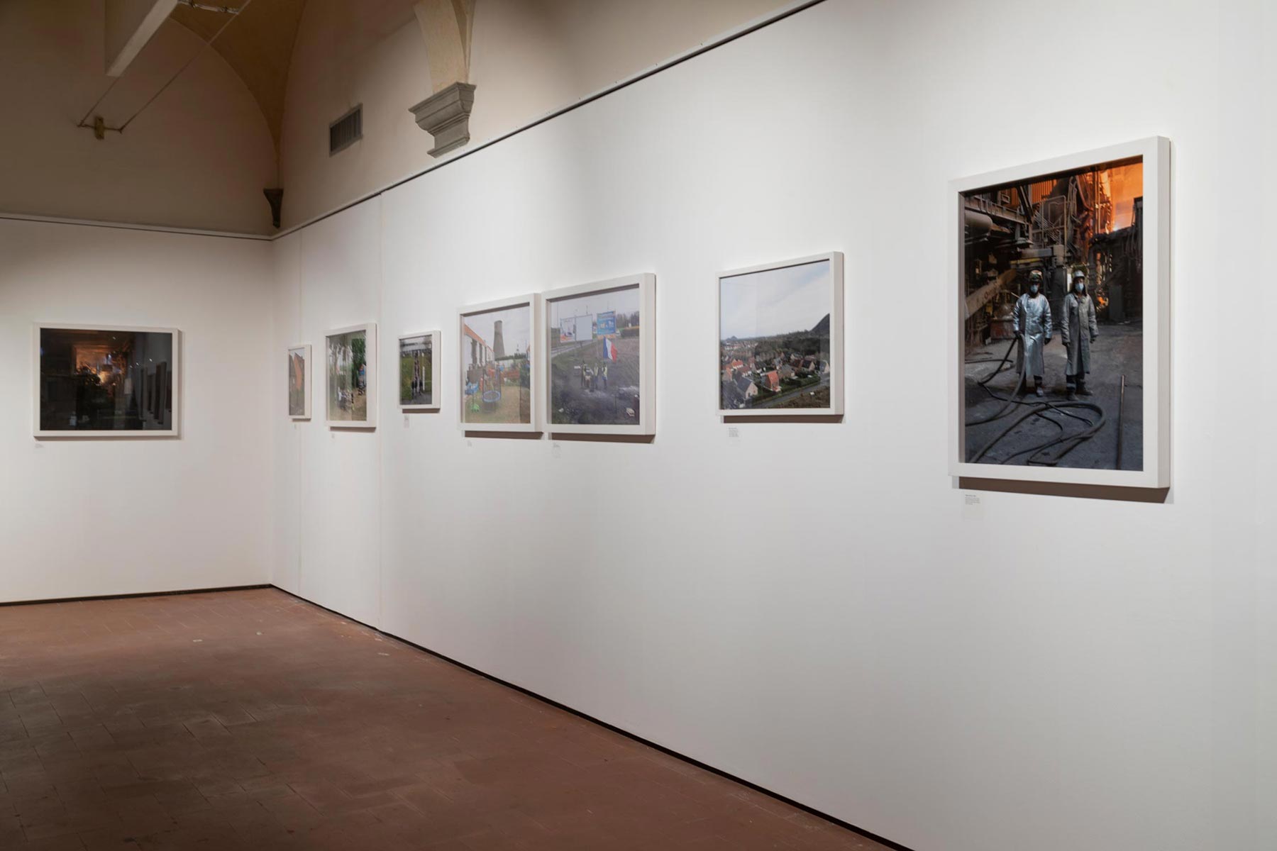
Valenciennes, 2021. From left, Eric Bouchet and Cedric Bruggeman at the blast furnace; they have worked for Ascoval for 16 years.
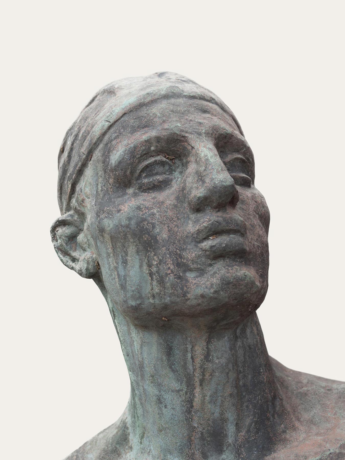
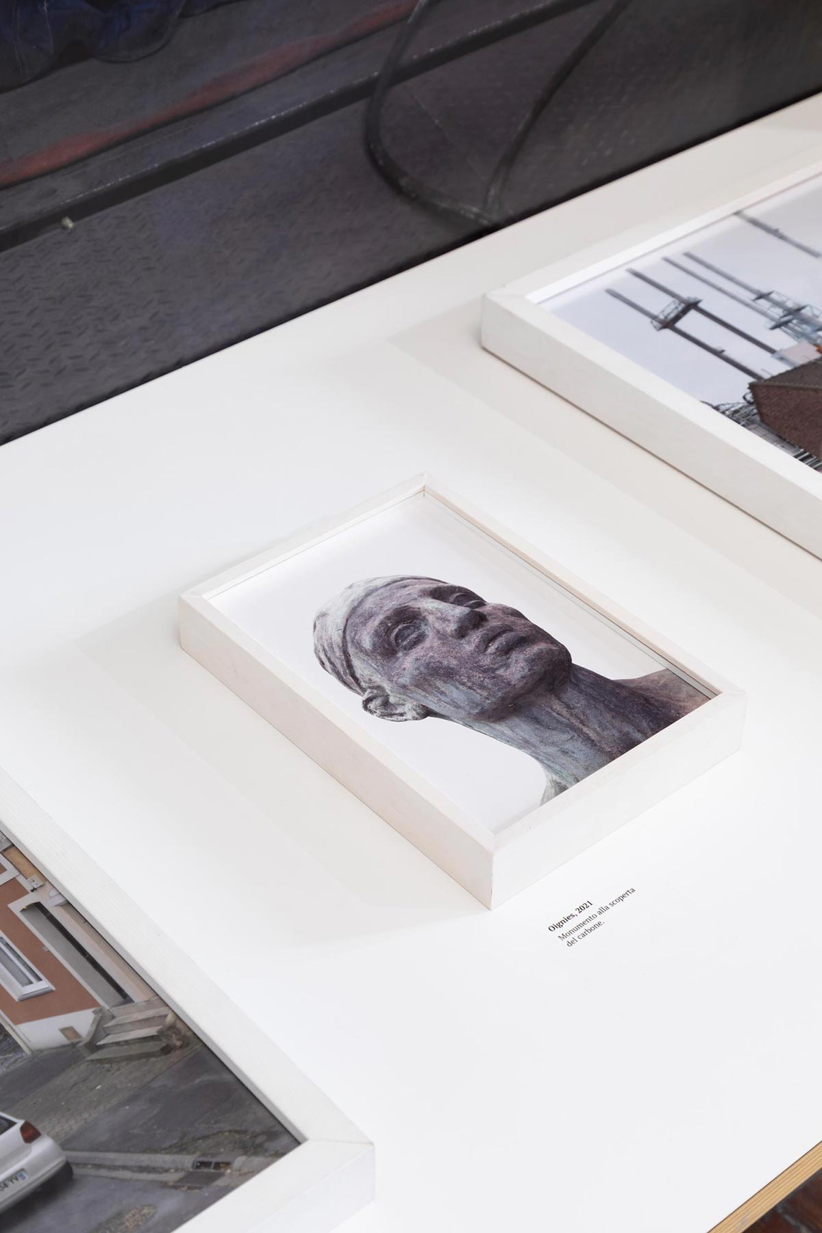
Oignies, 2021. #1, monument to the discovery of coal
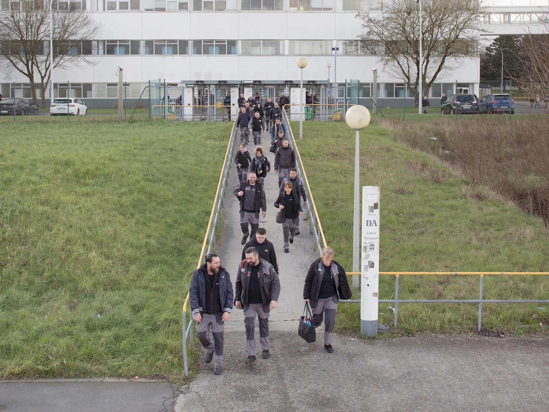
Douai, 2020. Renault workers leaving the gates of the factory’s assembly unit.
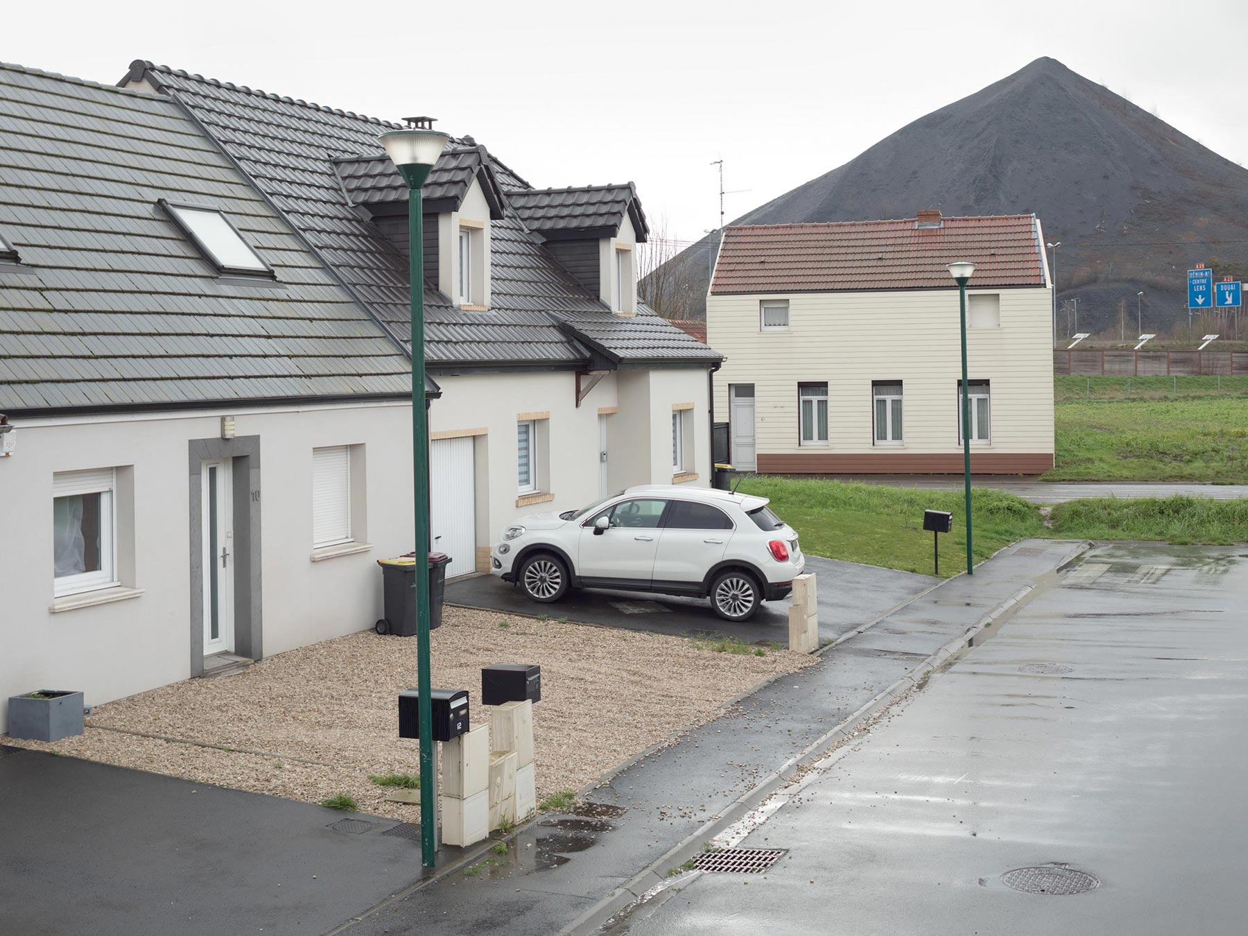
Noyelles-Godault, 2020. Terril n. 87
Mapping the rust
Fondazione Ordine degli Architetti di Milano
118 pages
Soft cover
English and Italian
Text by Roberta Valtorta
Fondazione Ordine degli Architetti di Milano, September 2021
Murate Art District, June 2022
